Terminus Changes and Length History
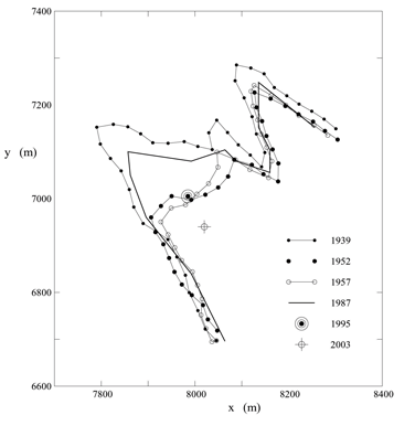
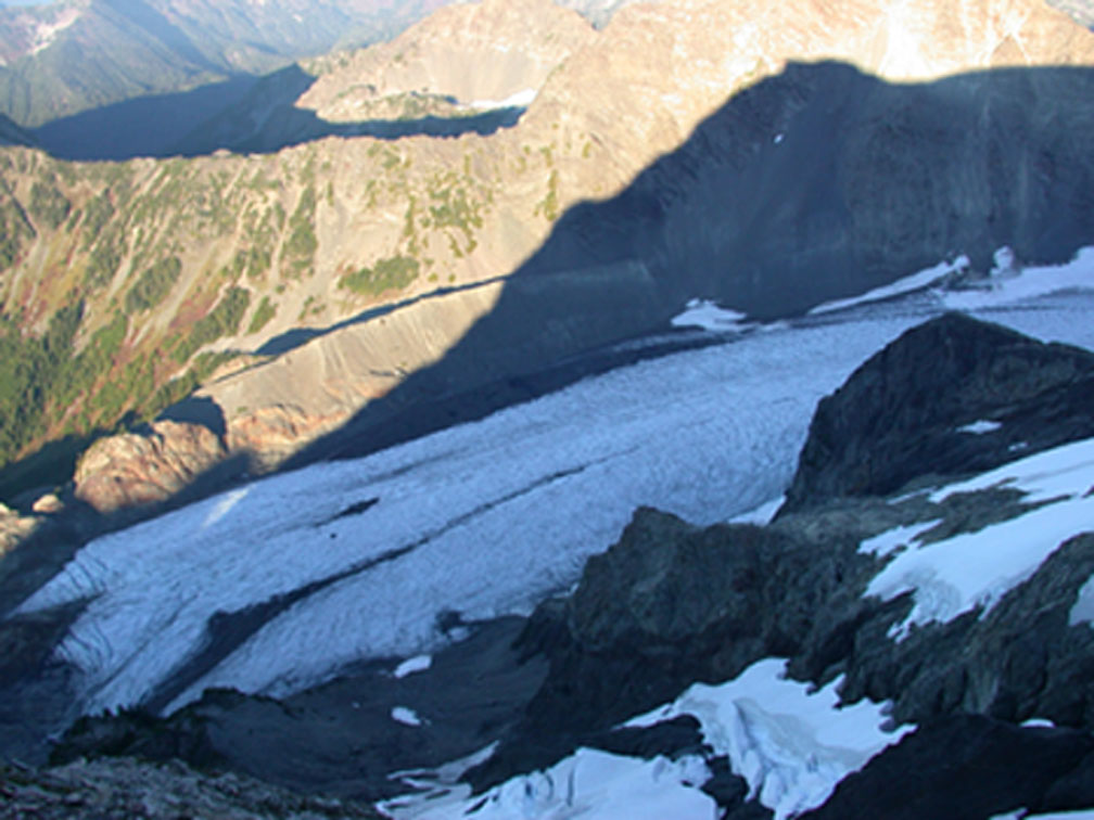
The terminus position, or end of the glacier, has been measured across the full glacier edge and at point locations. The below plot shows measured positions for various years from 1939-2003. The axes of the plot represent spatial position of the points in x-y coordinates. The right photo (taken in September 2003) is overlooking the terminus of Blue Glacier, showing the two distinct lobes apparent in the plot.
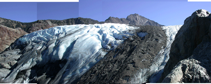
Photo mosaic showing the larger lobe of the terminus in 2003.
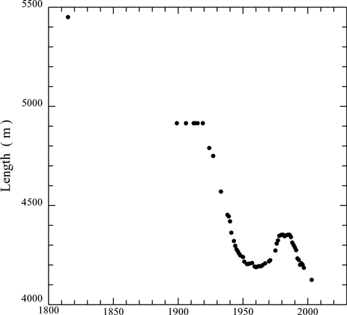
Evidence from terminal moraines indicates that about 1815 the termini of both Blue and White Glaciers were joined in Glacier Creek. White Glacier is in the next valley to the west. By the mid 1950's Blue Glacier had retreated more than 1400 m and has remained near that position for the past 40 years as shown in the below plot of length history. Recent measurements, however, indicate that the mass balance has been strongly negative since 1976, and the glacier is now well out of equilibrium with the present climate. Retreat of Blue glacier is currently being observed.