
|
|
|
|
|
|
|
The West Antarctic Ice Sheet is a marine ice sheet with a bed that
lies largely below sea level. It is potentially unstable, and there is
the possibility of sudden discharges of ice form the interior of the
ice sheet to the ocean with consequent meter-scale rise in global sea
level (Fig.
1) . Most of the present ice discharge occurs in fast moving bands
called ice streams that flow between much slower moving
inter-ice-stream ridges. |
| A crucial question is what determines the locations, widths and speeds of the ice streams. This project seeks to gain information about the past history of the West Antarctic Ice Sheet and its ice streams using geophysical methods to map the present flow and internal stratigraphy of the ridge between Ice Streams C and D known as Siple Dome. The geophysical measurements also set the context for locating a deep core to determine past climate conditions from measurements on the cores. The University of Washington (UW) is working in collaboration with colleagues at St. Olaf College (SOC) and University of Colorado (UC). |
|
| Figure 1. (9K) Map of the Siple Cost of the West Antarctic Ice Sheet showing the location of Siple Dome. |

|

|
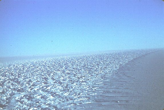
| Figure 2.(328K) Airborne view of frost fingers on the flank of Siple Dome. | Figure 3. (315K) Margin of Ice Stream D bordering Siple Dome. Slow-flowing ice is to the right and fast-flowing ice is to the left. |

| During the 1994 field season, our field team (Howard Conway, Tony Gades, Robert Jacobel, Nadine Nereson, Charles Raymond and Ted Scambos) mapped the upper surface of the ice, internal layers and the bed using a combination of Global Positioning System (GPS) surveying (see Fig. 6 and Fig. 7)and ice penetrating radar echo sounding (RES) traverses (see Fig. 8 and Fig. 9). The measurements are concentrated in the summit area of the dome to aid in the selection of the precise site of a deep core and its analysis to obtain a high resolution history of climate. Traverses were also made toward the margin of ice stream D to investigate a prominent "scar" in the surface that runs from ice stream C toward ice stream D along the northeast flank of the dome (Fig. 5). |
| Figure 4. (300K) 1996 Field Team members from left to right: Nadine Nereson, Ted Scambos, Charles Raymond and Robert Jacobel. |
| During the 1996 field season some of us (Jacobel, Nereson, Raymond and Scambos, see Fig. 4) returned to Siple Dome to re-survey poles placed in the ice in 1994 and to extend our survey and RES measurements along the southern flank of Siple Dome toward Ice Stream C. Figure 5 shows the main lines along which GPS survey and radar measurements were made. These measurements give us information about the geometry of the surface, bed, and internal layers over the full width of Siple Dome. |
 |
| Fig. 5.(235K)Satellite image courtesy of Ted Scambos showing Ice Streams C and D and an old ice stream margin along the relict "Siple Ice Stream". |

|

|

|

|
| Figure. 6 (247K) Nadine Nereson making GPS measurements near the Siple Dome Ice Stream. Markers were surveyed using a combination of fast static and stop-go kinematic GPS methods. | Figure 7. (390K) Ted Scambos making GPS survey measurements at the Siple Dome summit. | Figure 8. (125 K) Tony Gades, Robert Jacobel and Howard Conway examine display of a radar profile on a lap-top screen just after collection. | Figure 9. (250K) Robert Jacobel tests the radar system used in 1996. |
The cross profile of the dome surface, internal layers and bed (Fig. 10) shows several important features. The internal layers at depth are abruptly cut off beneath the prominent "scar" in the surface that runs from Ice Stream C toward Ice Stream D along the northeast flank of the dome. This observation proves that this feature is an important dynamic boundary. It is probably the relict margin of a former ice stream that flowed as recently as 1300 years ago from the present position of Ice Stream C toward Ice Stream D. Evidently the configuration of ice streams can change with time, which poses new challenges to understand their contribution to ice discharge to the ocean. (See Jacobel and others, 1996.)
Figure 10. Radar profile from Ice Stream C, over Siple Dome divide at its summit, to the Siple Dome Ice Stream. This radar profile corresponds to the white line shown in Figure 5. Click on the thumbnail image to see the (A) southern flank, (B) the northern flank, or (C) the entire profile.
|
Beneath the crest of the dome, the internal layers are warped upward as a result of a localized near divide flow regime. By analyzing the shapes of the layers, we have concluded that the crest of Siple Dome has been migrating northward toward Ice Stream D for at 10-40 centimeters per year for at least the last several thousand years (Fig. 11, Nereson and others, in preparation). This divide migration indicates transient conditions in the flow regime associated with either changes in the bounding ice streams or the spatial pattern of accumulation. We have used a linearized perturbation analysis to investigate these possibilities. Our analysis shows that either a modest increase in the south-north accumulation gradient over time, or an thickening of the northern boundary of Siple Dome at .01 to .04 meters per year would produce the rate of divide migration we infer (Nereson and others, submitted). The continuity of the layering over the depth range of detection implies that the stratigraphy is intact at least through the Holocene and probably back much farther than that. One result of the divide migration is that the thickest pre Holocene ice lies about 0.5 km south of the present divide. |

|
|
Figure 11.(38K) (a) Radar profile of Siple Dome 10 km cross-section perpendicular to the divide at the summit. Measurements were made every 100 meters with a center frequency of 2 Mhz. (b) Radar profile of a 4 km cross-section. Measurements were made every 20 meters with a center frequency of 5Mhz. The apex of selected internal layers is marked with a black dot. The solid line shows the south-north trend of the apex axis. |
Jacobel, R, T. Scambos, C.Raymond, and A. Gades. 1996. Changes in the configuration
of Ice Stream flow from the West Antarctic Ice Sheet, J. Geopys. Res.,
101(b3): 5499--504.
Nereson, N.A., E.D. Waddington, C.F. Raymond, and H.P. Jacobsen. 1996.
Predicted age-depth scales for Siple Dome and inland WAIS ice cores in
West Antarctica, Geophys. Res. Let., 23(22): 3163--3166.
Nereson, N.A., R.C.A. Hindmarsh, C.F. Raymond. in press. Sensitivity of
the divide position at Siple Dome, West Antarctica to boundary forcing,
Annals of Glaciology, V 27.
Nereson, N.A., C.F. Raymond, E.D. Waddington, and R.W. Jacobel. in
press. Migration of the Siple Dome Ice Divide, West Antarctica. Journal of
Glaciology.
Scambos, T.A., N.A. Nereson and M.A. Fahnestock. in press. Detailed
Topography of Roosevelt Island and Siple Dome, West Antarctica, Annals of
Glaciology, V 27.
West Antarctic Ice Sheet Initiative
WAISCORES: Deep Ice
Coring in West Antarctica
[Return
to Glaciology Project Page]


