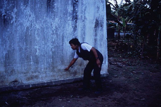
All of these images were taken between 4 and 6 p.m. on April 25, 1995 by Dr. Bruce Jaffe of the USGS.
Water line on south wall of building left standing approximately
200 m inland near the maximum extent of runup. View looking north near
middle of pre-tsunami village, Lampon, Java.
![[Help]](/tsunami/images/help.gif)
![[Table of Contents]](/tsunami/images/tcarrow.gif)
![[Events]](/tsunami/images/events.gif)
![[East Java]](/tsunami/images/eastjava.gif)
![[Lampon]](/tsunami/images/lampon.gif)