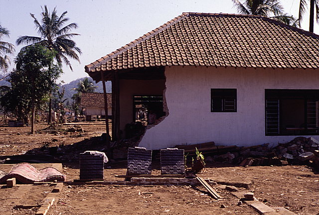
Tsunami-damaged brick home in Pancer. Home is located approximately 400 m from the beach. View looking west, with beach located to the left.
View to southeast looking inland. Note the partially-destroyed pump station shown in the center of the image, with the elevated open channel extending off to the left.
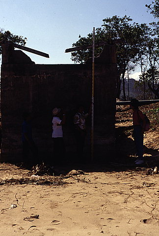
View looking inland at the seaward face of the pump station. This pump station was a composite structure: The lower walls were concrete; the upper walls were masonry block; and the roof was made of wood. The tsunami swept the wooden roof off the masonry walls. The masonry wall across the seaward face of the pump station was partially destroyed by the tsunami. The top of the masonry wall is 6.3 meters above mean sea level.
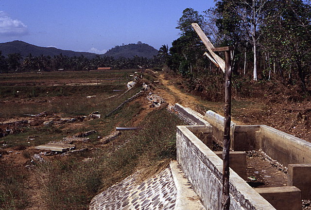
Toppled shrimp-pond dike wall approximately 370 meters inland from the pump station. The top of the remaining wall is approximately 5.7 meters above mean sea level. The picture was taken from the top of the elevated open channel that extended out to the pump station.
![[Help]](/tsunami/images/help.gif)
![[Table of Contents]](/tsunami/images/tcarrow.gif)
![[Events]](/tsunami/images/events.gif)
![[East Java]](/tsunami/images/eastjava.gif)
![[Pancer]](/tsunami/images/pancer.gif)