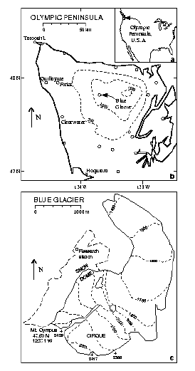
(b) Olympic Peninsula with weather stations (open circles). Elevation contours for topography smoothed over 12 km.
(c) Blue Glacier and adjacent glacierized region not tributary to it (dashed), adapted from 1990 U.S. Geological Survey map Mount Olympus Quadrangle made from 8 August 1987 vertical photography. All elevations in meters above National Geodetic Vertical Datum of 1929.
Source: Rasmussen and others (2000, Figure 1)