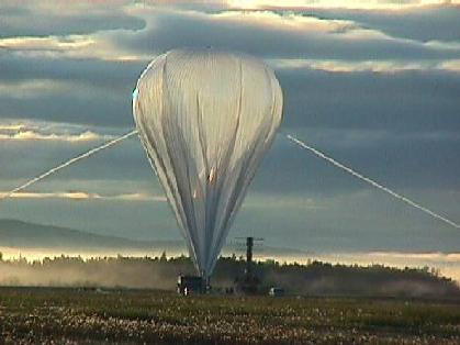
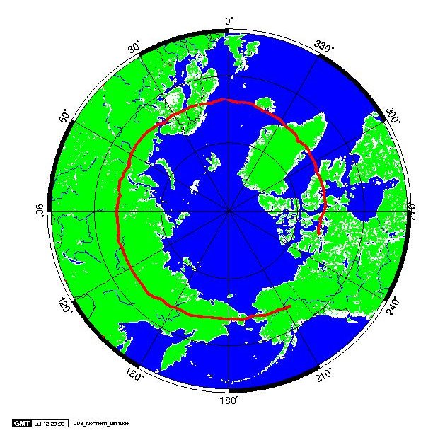
On June 29, 1998, we launched a balloon from Fort Wainwright, Fairbanks, Alaska. The balloon ascended to about 120,000 feet altitude and traveled from east to west around the North Pole. After about two weeks aloft, the flight was terminated on July 12, 1998, over Victoria Island, Canada, and the payload was recovered. This NSBF map shows the payload trajectory.
The participants in the project are:
The scientific purpose for the flight is to study electron precipitation from the magnetosphere into the ionosphere. This electron precipitation creates the visible northern lights along with X-rays which can be observed with our balloon instrumentation. For this project, the University of Washington provided two X-ray imaging cameras. One has a pinhole collimator and the other has a coded aperture mask collimator. Both cameras use scintillating crystals and photomultiplier tubes to detect X-rays which are produced in the aurora. The University of California at Berkeley provided a high resolution germanium X-ray spectrometer. All of these instruments flew on the INTERBOA campaign in 1996.