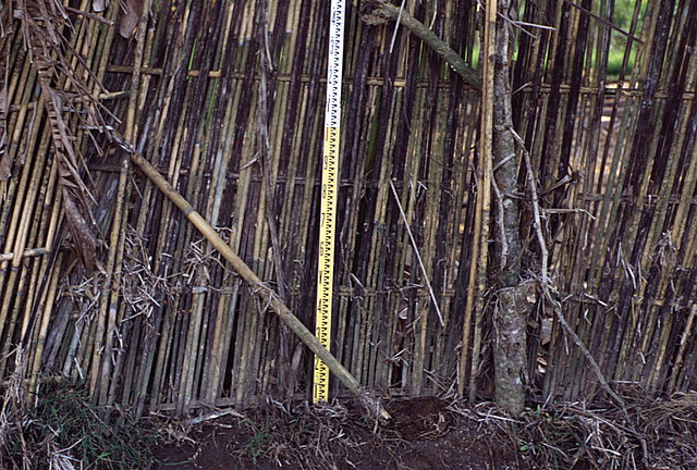
Runup at this location, about 250 meters from the beach at Rajekwesi, measured 4.2 meters above mean sea level. The debris line on this fence, located at about the 0.5 meter mark on the surveying rod, was used as a trace mark for the runup measurement.
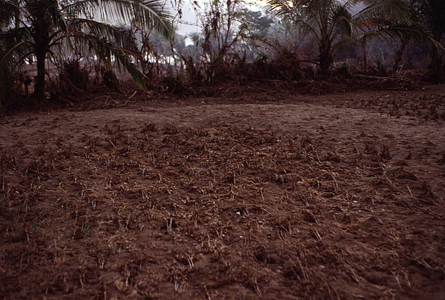
Peanut plants uniformly bent over by overland flow from the tsunami.
![[Help]](/tsunami/images/help.gif)
![[Table of Contents]](/tsunami/images/tcarrow.gif)
![[Events]](/tsunami/images/events.gif)
![[East Java]](/tsunami/images/eastjava.gif)
![[Rajekwesi]](/tsunami/images/rajekwesi.gif)