This web page contains information concerning a workshop focused on the application of the geologic record of tsunamis. Earth scientists from all over the world convened in June of 2005 to discuss issues brought to the forefront of research by the recent Sumatra-Andaman earthquake and its global tsunami.
The workshop was funded primarily by the National Science Foundation (NSF) and hosted by the department of Earth and Space Sciences (ESS) at the University of Washington (UW).
Primary organizers:
Joanne Bourgeois (jbourgeo@u.washington.edu)
Harry Yeh (harry@engr.orst.edu)
Brian Atwater (atwater@u.washington.edu)
Contributing NSF programs:
Instrumentation & Facilities
Marine Geology and Geophysics
Ocean Drilling Program
Geomorphology and Land Dynamics
Sedimentary Geology and Paleontology
Geomechanics and Geotechnical Systems
East Asia and Pacific
Americas
Central Europe and Eurasia
Africa, Near East and South Asia
Other Contributors:
United States Geological Survey (USGS)
University of Washington (UW) - Earth and Space Sciences (ESS)
National Oceanographic and Atmospheric Administration (NOAA)
PROJECT SUMMARY
Established and emerging leaders in tsunami research came together with the common goal of advancing the understanding of tsunami behavior as reflected in coastal erosion and deposition. The recent Sumatra-Andaman earthquake and its global tsunami highlight the importance of these topics; topics that need to be fully understood in order to define earthquake and tsunami hazards. Outcomes of the workshop include future recommendations to NSF on tsunami research priorities and a brochure summary of conclusions to be distributed to policymakers.
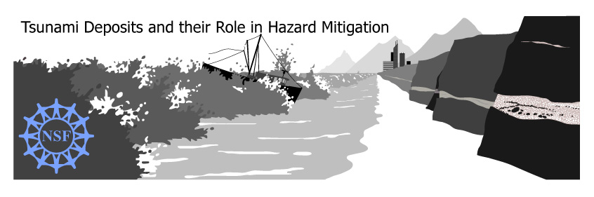
Tsunamis happen often in the world's oceans on both human and geologic time scales. Most tsunamis result from fault displacement under the sea; others are set off by submarine landslides, volcanic eruptions, and meteorite impacts. Barely two decades have passed since geologists began using onshore sedimentary deposits to identify tsunami risk areas. The work has produced startling discoveries, particularly in the northwestern United States. However, basic questions remain, such as how does one distinguish tsunami deposits from storm deposits in coastal areas with large storm surges? Tsunami deposits have enormous potential as recorders of flow depth and velocity - parameters of importance to coastal engineers. Geologists, sediment-transport experts, numerical tsunami modelers, and experimentalists are collaborating on this new frontier. This workshop provided a venue for specialists to weigh priorities and collaborate on research.
There are three avenues to consider when addressing tsunami hazards: assessment, mitigation, and warning. Some examples of the major means of assessment is quantifying recurrence, intervals and size estimates of past events, and tsunami-deposit studies are an important means for doing so. Moreover, tsunami-deposit studies can help in generating public education and awareness - an important aspect of mitigation efforts. The 26 December 2004 tsunami tragically demonstrated the global need for tsunami-hazard assessment, tsunami education, and community preparation. This workshop brought together scientific researchers and educators, as well as government and community representatives, in order to develop means for improving the communication of tsunami research results to potentially affected communities.
The workshop was organized around the following questions, which range from basic science to applications in the public sphere:
· How can tsunami deposits be distinguished from hurricane and other storm deposits?
· How can properties of tsunami waves be quantified from their deposits?
· What are the geomorphic effects of tsunami erosion and deposition?
· What is required to construct a database that includes documented historic and prehistoric tsunami deposits and other geologic evidence of tsunamis?
· What is the best way to use tsunami geology to constrain coastal hazard maps and help construct probabilistic hazard assessment maps?
· How best can the significance of tsunami deposits be explained to the public and used for outreach and education?
Home | Agenda | Topics and Breakout Groups | Participants | Field Trips | Downloads
Last Updated October 26, 2005